|
||
|
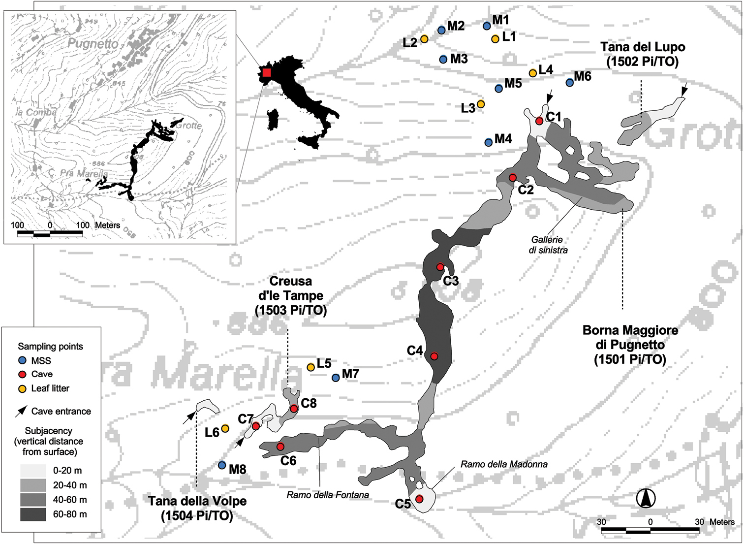
Map of the study area. The shape and the topographic position of the four caves (Borna Maggiore di Pugnetto, Tana del Lupo, Creusa d’le Tampe, Tana della Volpe) was obtained from the original planimetric drawings of Muratore (1946). The position of the sampling plots in caves (“cave triplets”, C1–C8), in the MSS (“MSS triplets”, M1–M8) and in the leaf litter (“epigean”, L1–L6) are represented by coloured dots. The different sectors of the cave are coloured with different shades of grey representing the subjacency – i.e., vertical distance from the surface – according to Motta and Motta (2015). |