|
||
|
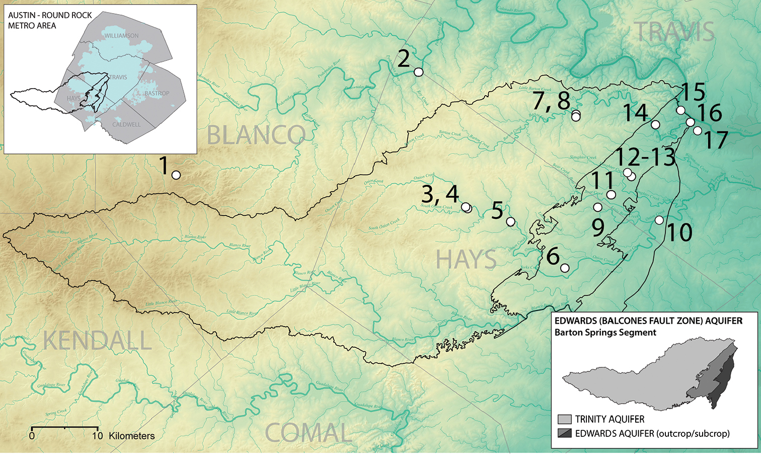
Sample Sites. Sampling map showing the extent of the Barton Springs Segment of the Edwards (Balcones Fault Zone) Aquifer and its hydrozones in Hays, Travis, and Blanco counties, Texas, USA. Sampling sites are numbered as follows: 1 Bamberger Ranch Spring 2 Red’s Spring 3 Emerald Spring 4 Bello Spring 5 Ben McCulloch Spring 6 Sky Ranch Tract - State Well No. 5857507 7 Sweetwater Spring 4 8 Sweetwater Spring 1 9 Hays County Ranch Tract - State Well No. 5849939 10 Old San Antonio Spring 11 Ed’s Crossing Tract - State Well No. 58499SH 12 Blowing Sink Cave 13 Blowing Sink Tract - State Well No. 5850411 14 Barton Creek Greenbelt - State Well No. 5842820 15 Cold Spring 16 Eliza Spring 17 Treadwell Spring. Boundaries of aquifer hydrozones courtesy of the Barton Springs Edwards Aquifer Conservation District. Wells are identified primarily by the Texas Water Development Board (TWDB) well-numbering system (Nordstrom and Quincy 1999). |