|
||
|
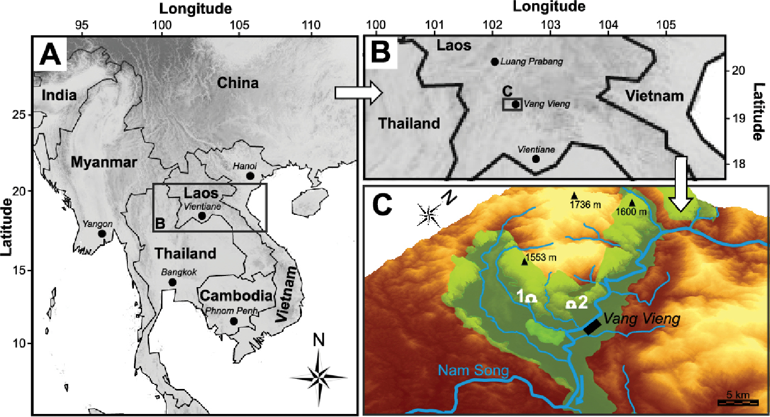
Location and topography of type locality A, B maps showing Laos, the geographical origin of the type localities of Laoennea species, L. renouardi sp. nov. and L. carychioides. The greyscale indicates the local mean elevation. This map was downloaded from WORLDCLIM (Hijmans et al. 2005) and political borders were retrieved from Esri Data and Maps (2002) C topographical map indicating geological formations and the type locality caves, 1 Tham Pou Kham (L. carychioides) and 2 Tham Houey Yè (L. renouardi sp. nov.) in two independent karst networks. The map was created using QGIS software 2.18.24. The source of the data for the digital elevation model is SRTM 30 m. |