|
||
|
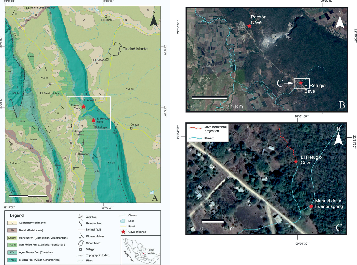
A general geologic map of the northern part of the Sierra del Abra showing the locations of the El Refugio and Pachón caves entrances at the geological contact between Agua Nueva and San Felipe formations (modified from Carta Geológico-Minera Ciudad Mante F14–5) B satellite view showing the principal streams near the cave entrances C detailed view of B. The cave horizontal projection of the El Refugio cave is observed in a red line as also the position of the Manuel de la Fuente Spring. In blue are stream beds that only carry water during the rainy season. |